 |
| The Blue Heron Coal Camp Scale Model at Big South Fork NRAA |
The Stearns Coal and Lumber Company began operation in 1902 on land purchased in Kentucky and Tennessee. At the same time that the lumber industry was being established coal mining operations began. The first Stearns Company coal mine opened in 1902 and the first coal shipments were made in 1903. In 1918 the lumber industry was dwindling in Mason County, Michigan and Mr. Stearns closed the lumber company.
 |
| Coal Conveyor Over the Big South Fork Modified for Foot Travel (Compare with photo of the conveyor during mine operation) |
 |
| Coal Conveyor for Bringing Coal to the Tipple at Mine 18 (Blue Heron Mine) |
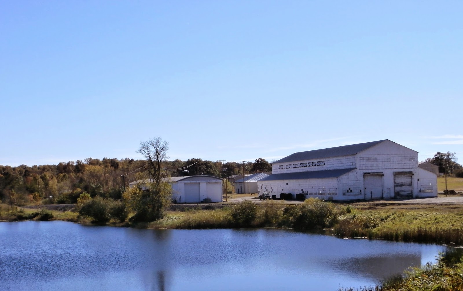 |
| Kentucky and Tennessee Railroad Pond and Locomotive Shop, Stearns, KY |
The company continued under Justus Sterns’ offspring. Robert L. Stearns, Sr., Robert L. Stearns, Jr. and Robert Eiledy Gable all ran the company over the time of the Stearns Company’s presence in Kentucky and Tennessee. In the 1902 the Stearns company began building a railroad to connect the mines to the Southern Railroad. The Stearns Railroad became the Kentucky and Tennessee railroad.
It reached mine No. 1 at Barthell, mine No. 4 at Worley, mine No. 11 at Yamacraw, Cooperative Coal Company at Cooperative,; mine No. 15 at White Oak, and mine "A" at Fidelity. Cooperative was a new mine which was organized to give Stearns employees the privilege of buying its stock and sharing its earnings. The Kentucky and Tennessee railroad also ran to the Paint Cliff Mine Company, , the St. Mihiel Coal Company at Oz, and the Camargo Coal Company at Camargo. The president of the Paint Cliff mine company was Kenneth Meguire of Louisville. Later the Railroad reached Mine 18 at Blue Heron.
It reached mine No. 1 at Barthell, mine No. 4 at Worley, mine No. 11 at Yamacraw, Cooperative Coal Company at Cooperative,; mine No. 15 at White Oak, and mine "A" at Fidelity. Cooperative was a new mine which was organized to give Stearns employees the privilege of buying its stock and sharing its earnings. The Kentucky and Tennessee railroad also ran to the Paint Cliff Mine Company, , the St. Mihiel Coal Company at Oz, and the Camargo Coal Company at Camargo. The president of the Paint Cliff mine company was Kenneth Meguire of Louisville. Later the Railroad reached Mine 18 at Blue Heron.
The Big South Fork NRAA is one of
only two national parks designated “national river and recreation area” (the
other being the Mississippi National River and Recreation Area in the
Minneapolis-St. Paul vicinity). The Big South Fork is a place once broken with rapacious
timber cutting but now healing under protection of the National Park Service.
Located high atop the Cumberland Plateau in McCreary County
Kentucky and Pickett and Scott Counties in Tennessee Big South Fork has more
than 125,000 acres of land. Big South Fork is a geological and historical resource. The land has deep gorges carved by erosion,
historic homesteads of a bygone era, and scenic rockshelters and sandstone
arches.
An ancient inland sea covered this part of America some 320
million years ago. The sandbars, deltas, beaches, and dunes were compressed and
cemented over millions of years, becoming fine-grained sandstone. Other
sedimentary rocks were formed in some places as well, including siltstone,
shale, and coal.
The sedimentary rock strata of the Cumberland Plateau are
layered. Atop these strata sits a layer
of rock called the Rockcastle Conglomerate. This rock consists of
cemented-together coarse sand and small pebbles from ancient braided
streambeds. The Rockcastle Conglomerate layer functions as a cap rock because
it is very erosion-resistant.
As the land tilted upward rose, replacing the sea with
highlands, rivers became a powerful force for cutting into the landscape. Where
the running water breached the erosion resistant conglomerate cap rock, it was
able to carve deeply into the softer sedimentary rock below. This vigorous cutting
created gorges, cliffs, bluffs, and arches. Over time, these processes gave
birth to the Big South Fork landscape of today.
No comments:
Post a Comment